Coder Social home page Coder Social logo

countrymetadata's Introduction

StreetComplete

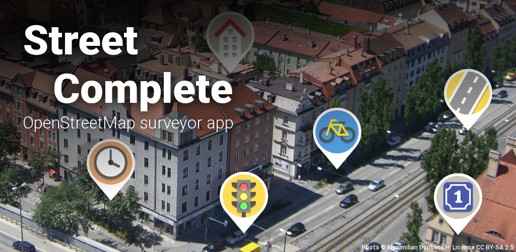
StreetComplete is an easy to use editor of OpenStreetMap data available for Android. It can be used without any OpenStreetMap-specific knowledge. It asks simple questions, with answers directly used to edit and improve OpenStreetMap data. The app is aimed at users who do not know anything about OSM tagging schemes but still want to contribute to OpenStreetMap.

StreetComplete automatically looks for nearby places where a survey is needed and shows them as quest markers on its map. Each of these quests can then be solved on site by answering a simple question. For example, tapping on a marker may show the question "What is the name of this road?", with a text field to answer it. More examples are shown in the screenshots below.

The user's answer is automatically processed and uploaded directly into the OSM database. Edits are done in meaningful changesets using the user's OSM account. Since the app is meant to be used on a survey, it can be used offline and is economic with data usage.

To make the app easy to use, quests are limited to those answerable by asking simple questions.

Screenshots

Download

Get it on Google PlayGet it on F-DroidDownload APK from GitHub

Quests

There are quite a few different quest types now and more will be added over time. You can see a community-managed list of all quests in the OSM wiki.

FAQ

You can find a list of frequently asked questions in the wiki.

Contributing

This is an active open-source project, so you can get involved in it easily! You can do so without any programming or OpenStreetMap knowledge! Just choose a task that you like.

Here are a few things you can do:

Also, if you like StreetComplete, spread the word! ❤️

License

This software is released under the terms of the GNU General Public License.

Sponsors

GitHub Sponsors Liberapay Patreon
Many users are currently supporting this app through GitHub sponsors, Liberapay and Patreon. If you like the app, you can join them ☺️ to support the continued development and maintenance of the app.

German Federal Ministry of Education and ResearchPrototype Fund
Within the frame of Prototype Fund round 15 (March 2024 to August 2024), the German Federal Ministry of Education and Research currently sponsors Tobias Zwick to work on StreetComplete for iOS.
Development on this app was also sponsored in round 8 (September 2020 to February 2021) of the Prototype fund, with focus on collecting more data points and on general improvements of this app.

JawgMaps
Since mid 2020, JawgMaps provides their vector map tiles service to StreetComplete for free, i.e. the background map displayed in the app.

Past Sponsors

nlnet
The NLnet foundation sponsored development on this app in three individual grants with funds from the European Commission:
Two grants given to Mateusz Konieczny in 2019 and 2021 enabled him to work on StreetComplete for about one year in total, with a focus on clearer UI and improvements on data collection. Furthermore, yet another grant enabled Tobias Zwick to work about five months in 2021/2022 on - most notably - the overlays functionality and measuring with AR.

OpenStreetMap foundation
In August 2020, the OpenStreetMap foundation funded the development of Map Maintenance with StreetComplete within the frame of the microgrants program.

countrymetadata's People

Contributors

1ec5 avatar arrival-spring avatar bgo-eiu avatar ctjoriginal avatar floedelmann avatar frankie2784 avatar i-ky avatar matkoniecz avatar mnalis avatar peternewman avatar westnordost avatar

Stargazers

 avatar  avatar  avatar  avatar  avatar  avatar  avatar  avatar  avatar  avatar  avatar  avatar  avatar  avatar

Watchers

 avatar  avatar  avatar  avatar  avatar  avatar

countrymetadata's Issues

Localize no stopping sign for Puerto Rico

The country metadata for Puerto Rico correctly specifies a Puerto Rico–specific no parking sign that says “No Estacione”, but it falls back to the English-language no stopping sign used on the mainland:

https://github.com/streetcomplete/StreetComplete/blob/6609fd3c31099d02535cb618f13e572eafecc7b8/app/src/main/assets/country_metadata/PR.yml#L4-L5

According to the Manual de Rotulación para las Vías Públicas de Puerto Rico, Puerto Rico’s MUTCD supplement, the correct sign in Puerto Rico says “No Pare”, and then “No Estacione” below for good measure:

R7-4

I think it’s safe to assume that no standing signs don’t exist in Puerto Rico. The supplement doesn’t define a no standing sign. Even though it’s just a supplement, rather than a full state edition that overrides the national MUTCD, the highway authority is very consistent about only posting Spanish-language signs, so a “No Standing” sign would be very unlikely.

Hacktoberfest 2022

Basically the same request as streetcomplete/StreetComplete#2157:

@westnordost Would it be fine for you to opt into Hacktoberfest by adding the hacktoberfest topic to the repo? Contributions are much easier in here than in the StreetComplete repository, and might lure new contributors into contributing to StreetComplete in general.

"Advisory bike Lanes" in the us?

I was mapping bike lanes and realized that with the last update there is no longer the ability to mark a section of road as having dashed/advisory bike lanes.

I saw the issues opened about some other countries which don't have that or were confusing and it looks like you are still doing research for country specific implementations of it, wanted to add some pictures of lanes here in California in case it helps.

advisorylanes

vs normal

bikelane

Maybe I'm just misunderstanding the purpose of the dashed lane but I think it shouldn't have gone away here in the US

LengthUnits in Canada

In Canada, StreetComplete uses the global default length units of metres for measurements of height and width. While all official street signs are demarcated in metres, signs on private property frequently use both metres and feet/inches or only feet/inches.

This has caused particular problems in completing "What height limit is indicated here?" quests on garage entrances where signs are in feet/inches and StreetComplete only allows input in metres.

Suggested fix: add the following line to countrymetadata/data/lengthUnits.yml:

CA: [meter, foot and inch] # official signs use metric but imperial measurements common on private property

Apologies, new to GitHub, there is probably a way to make this fix directly

Recommend Projects

  • React photo React

    A declarative, efficient, and flexible JavaScript library for building user interfaces.

  • Vue.js photo Vue.js

    🖖 Vue.js is a progressive, incrementally-adoptable JavaScript framework for building UI on the web.

  • Typescript photo Typescript

    TypeScript is a superset of JavaScript that compiles to clean JavaScript output.

  • TensorFlow photo TensorFlow

    An Open Source Machine Learning Framework for Everyone

  • Django photo Django

    The Web framework for perfectionists with deadlines.

  • D3 photo D3

    Bring data to life with SVG, Canvas and HTML. 📊📈🎉

Recommend Topics

  • javascript

    JavaScript (JS) is a lightweight interpreted programming language with first-class functions.

  • web

    Some thing interesting about web. New door for the world.

  • server

    A server is a program made to process requests and deliver data to clients.

  • Machine learning

    Machine learning is a way of modeling and interpreting data that allows a piece of software to respond intelligently.

  • Game

    Some thing interesting about game, make everyone happy.

Recommend Org

  • Facebook photo Facebook

    We are working to build community through open source technology. NB: members must have two-factor auth.

  • Microsoft photo Microsoft

    Open source projects and samples from Microsoft.

  • Google photo Google

    Google ❤️ Open Source for everyone.

  • D3 photo D3

    Data-Driven Documents codes.