Coder Social home page Coder Social logo

nvkelso / natural-earth-vector Goto Github PK

View Code? Open in Web Editor NEW
1.7K 75.0 367.0 11.37 GB

A global, public domain map dataset available at three scales and featuring tightly integrated vector and raster data.

Home Page: https://www.naturalearthdata.com/

License: Other

Makefile 2.27% HTML 96.21% Python 0.90% Shell 0.18% Dockerfile 0.01% R 0.39% Rich Text Format 0.05%
naturalearthdata gis map dataset

natural-earth-vector's Introduction

Get the full scoop at NaturalEarthData.com

No, really! This readme is a poor substitute for the live site.

About Natural Earth Vector

Natural Earth is a public domain map dataset available at 1:10m, 1:50m, and 1:110 million scales. Featuring tightly integrated vector (here) and raster data (over there), with Natural Earth you can make a variety of visually pleasing, well-crafted maps with cartography or GIS software.

Natural Earth was built through a collaboration of many volunteers and is supported by NACIS (North American Cartographic Information Society), and is free for use in any type of project (see our Terms of Use page for more information).

Get the Data »

Convenience

Convenience

Natural Earth solves a problem: finding suitable data for making small-scale maps. In a time when the web is awash in geospatial data, cartographers are forced to waste time sifting through confusing tangles of poorly attributed data to make clean, legible maps. Because your time is valuable, Natural Earth data comes ready-to-use.

Neatness Counts

Neatness Counts

The carefully generalized linework maintains consistent, recognizable geographic shapes at 1:10m, 1:50m, and 1:110m scales. Natural Earth was built from the ground up so you will find that all data layers align precisely with one another. For example, where rivers and country borders are one and the same, the lines are coincident.

GIS Atributes

GIS Attributes

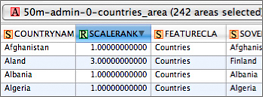
Natural Earth, however, is more than just a collection of pretty lines. The data attributes are equally important for mapmaking. Most data contain embedded feature names, which are ranked by relative importance. Other attributes facilitate faster map production, such as width attributes assigned to river segments for creating tapers.

Versioning

The 2.0 release in 2012 marked the project's shift from so-called marketing versions to semantic versioning.

Natural Earth is a big project with hundreds of files that depend on each other and the total weighs in at several gigabytes. SemVer is a simple set of rules and requirements around version numbers. For our project, the data layout is the API.

  • Version format of X.Y.Z (Major.Minor.Patch).
  • Backwards incompatible changes, increment the major version X.
  • Backwards compatible additions/changes, increment the minor version Y
  • Bug fixes not affecting the file and field names, patch version Z will be incremented.

Major version increments:

  • Changing existing data file names
  • Changing existing data column (field) names
  • Removing FeatureCla field attribute values
  • Additions, deletions to admin-0
  • Introduce significant new themes

Minor version increments:

  • Any shape or attribute change in admin-0
  • Additions, deletions, and any shape or attribute changes in admin-1
  • Additions, deletions to any theme
  • Major shape or attribute changes in any theme
  • Adding, changing FeatureCla field attribute values
  • Introduce minor new themes

Patch version increments:

  • Minor shape or attribute changes in any theme
  • Bug fixes to shape, attributes in any theme

Under this scheme, version numbers and the way they change convey meaning about the underlying code and what has been modified from one version to the next.

When we introduce a new version of Natural Earth, you can tell by the version number how much effort you will need to extend to integrate the data with your map implementation.

  • Bug fixes Z: can simply use the new data files, replacing your old files.
  • Minor version Y: limited integration challenges.
  • Major version X: significatnt integration challenges, either around changed file strucutre, field layout, field values like FeatureCla used in symbolizing data, or significant new additions or significant changes to existing themes.

&etc

Natural Earth is maintained by Nathaneiel V. KELSO (@nvkelso) and Tom Patterson.

The project transitioned to Github in 2012. Versioned files are here to collaborate around. The frontend still lives at NaturalEarthData.com.

natural-earth-vector's People

Contributors

ajmas avatar elliotap avatar imresamu avatar matkoniecz avatar mfogel avatar migurski avatar mizmay avatar mrgawsome avatar nvkelso avatar sebkur avatar

Stargazers

 avatar  avatar  avatar  avatar  avatar  avatar  avatar  avatar  avatar  avatar  avatar  avatar  avatar  avatar  avatar  avatar  avatar  avatar  avatar  avatar  avatar  avatar  avatar  avatar  avatar  avatar  avatar  avatar  avatar  avatar  avatar  avatar  avatar  avatar  avatar  avatar  avatar  avatar  avatar  avatar  avatar  avatar  avatar  avatar  avatar  avatar  avatar  avatar  avatar  avatar  avatar  avatar  avatar  avatar  avatar  avatar  avatar  avatar  avatar  avatar  avatar  avatar  avatar  avatar  avatar  avatar  avatar  avatar  avatar  avatar  avatar  avatar  avatar  avatar  avatar  avatar  avatar  avatar  avatar  avatar  avatar  avatar  avatar  avatar  avatar  avatar  avatar  avatar  avatar  avatar  avatar  avatar  avatar  avatar  avatar  avatar  avatar  avatar  avatar  avatar

Watchers

 avatar  avatar  avatar  avatar  avatar  avatar  avatar  avatar  avatar  avatar  avatar  avatar  avatar  avatar  avatar  avatar  avatar  avatar  avatar  avatar  avatar  avatar  avatar  avatar  avatar  avatar  avatar  avatar  avatar  avatar  avatar  avatar  avatar  avatar  avatar  avatar  avatar  avatar  avatar  avatar  avatar  avatar  avatar  avatar  avatar  avatar  avatar  avatar  avatar  avatar  avatar  avatar  avatar  avatar  avatar  avatar  avatar  avatar  avatar  avatar  avatar  avatar  avatar  avatar  avatar  avatar  avatar  avatar  avatar  avatar  avatar  avatar  avatar  avatar  avatar

natural-earth-vector's Issues

Add Salish Sea to marine label areas

http://t.co/hk3GFI6m

The term Salish Sea is quite new, dating officially from 2010 when both Canadian and American geographical boards adopted the name. The sea comprises of the Strait of Gerogia, Pugeot Sound and Strait of Juan de Fuca. Think of it this way, imagine if the Mediterranean Sea was only known as a group of a dozen seas (Aegean, Ionian, Adriatic, Tyrrhenian, Cilician, Libyan, Crete, Ligurian, Belearic, Alboran Seas, etc.) but had no unifying name. Well that's the case with the Salish Sea. A combination of a national border and somewhat unique geography likely prevented a unified name. Thanks to geographic societies and professionals we now have a unified name. Quick question: Is the Johnstone Strait part of the Salish Sea? Should it be included?

Add canals

Oh, I wish there was a shapefile with canals. Rhine-Danube, Volgo-Don, Belomorcanal and others

10m road has bad record

Hope you don't mind me opening an issue directly on here rather than posting elsewhere.

I was investigating a failure of some software which was blowing up when reading the 10m roads shapefile.
It turns out that my code doesn't handle empty points in a record, which is precisely what one of the records in this particular shapefile have:

import shapefile

fname = 'natural_earth/cultural/10m_roads.shp'
r = shapefile.Reader(fname)
rec = r.shapeRecord(8126)
field_names = [field[0] for field in r.fields[1:]]
for name, field in zip(field_names, rec.record):
    print '{}: {}'.format(name, str(field).strip())
print 'POINTS: ', rec.shape.points

Resulting in:

scalerank: 100
featurecla: Road
...
edited: Mystry can't be deleted?
name: 
...
POINTS: []

Obviously, I will update my code to handle a record with no points, but I wanted to let you know about this so that you can remove the lingering entry if you so wish.

Cheers,

Biggest Repo in github !

This is biggest repository in github ! More then 20GB !!!
Why you dont split this ?
Why you commit data db files ?
Github repo for cods and small files not this heavy files !

Naming of Russian lakes

Most reservoirs are called reservoirs, but the Votkinskoe vodokhranilishche is still called so, should be renamed Votkinsk Reservoir.

Secondly, when zooming from the 50 version to the 10 scale shp the Samara Reservoir is named first Samara (Kuybyshev) res., then simply Samara Reservoir. It's not consequent.

river Kama needs a more important scale rank 10m, 50m

The mighty river Kama deserves a place on the 50m theme. She's much bigger than the Danube, Mississipp, Rhinei or others

Between lake Onega and the White Lake/Lake Beloye in the southeast flows rivers Vytegra and Kovzha. Nowadays they form part of the Volgo-Baltic Waterway but they are still proper rivers themselves

Best regards Max S, Sweden

Add Korean islands under UN jurisdiction

KNM Korean islands under UN jurisdiction
B84 Korean islands under UN jurisdiction

N.L.L. Is.
NLL

Since 1953 islands south of maritime Northern Limit Line, patrolled by South Korea including Yeonpyeong, Baengnyeong, and Daecheong Is.

Recommend Projects

  • React photo React

    A declarative, efficient, and flexible JavaScript library for building user interfaces.

  • Vue.js photo Vue.js

    🖖 Vue.js is a progressive, incrementally-adoptable JavaScript framework for building UI on the web.

  • Typescript photo Typescript

    TypeScript is a superset of JavaScript that compiles to clean JavaScript output.

  • TensorFlow photo TensorFlow

    An Open Source Machine Learning Framework for Everyone

  • Django photo Django

    The Web framework for perfectionists with deadlines.

  • D3 photo D3

    Bring data to life with SVG, Canvas and HTML. 📊📈🎉

Recommend Topics

  • javascript

    JavaScript (JS) is a lightweight interpreted programming language with first-class functions.

  • web

    Some thing interesting about web. New door for the world.

  • server

    A server is a program made to process requests and deliver data to clients.

  • Machine learning

    Machine learning is a way of modeling and interpreting data that allows a piece of software to respond intelligently.

  • Game

    Some thing interesting about game, make everyone happy.

Recommend Org

  • Facebook photo Facebook

    We are working to build community through open source technology. NB: members must have two-factor auth.

  • Microsoft photo Microsoft

    Open source projects and samples from Microsoft.

  • Google photo Google

    Google ❤️ Open Source for everyone.

  • D3 photo D3

    Data-Driven Documents codes.