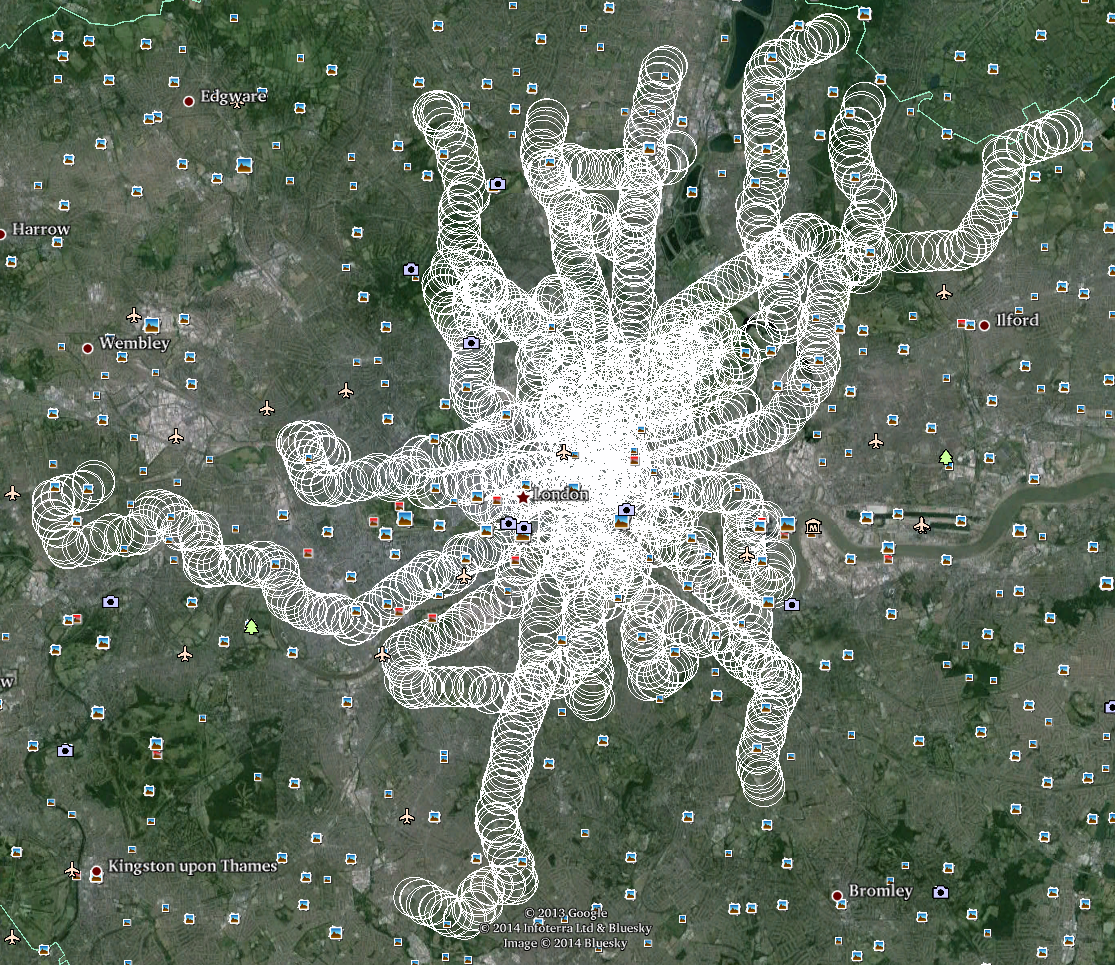
Tool to work out which bus stops you can reach directly from a radius around an initial bus stop.
Generates a .kml file which can be opened in Google Earth/Maps to see what areas you could commute directly from on a bus.
I currently always get a seat on my bus commute, and always having a seat means more time to spend coding side projects twice a day. I want to find out where else I can commute from and keep this project time intact. This project was created in a few such coding sessions.
pip install -r requirements.txt
Sign up for TFL api access and download the bus stops and bus routes csvs. Save
these to stops.csv and routes.csv
./main.py name radius
nameis the name of the bus stop you wish to commute toradiusis the distance, in metres, you're willing to walk to another bus stop nearby, from either the initial bus stop or any of the destination stops
Output will be saved to out.kml
./main.py "EPWORTH STREET" 700