
NB! geoflutterfire3 is the revisited & improved version of GeoFlutterFire
geoflutterfire3package was developped in mist of the developement of Swappers for the Global Gamers Challenge, a mobile app that connects swappers around the world and allows them to swap items easily and safely.

range queries on multiple fields is not suppoerted by cloud_firestore at the moment, since this library already uses range query ongeohashfield, you cannot perform range queries withGeoFireCollectionRef.GeoFlutterFire3now supports firestore rangestartAt() | endAt()queries!
limit()andorderBy()are not supported at the moment.limit()could be used to limit docs inside each hash individually which would result in running limit on all 9 hashes inside the specified radius.orderBy()is first run ongeohashesin the library, hence appendingorderBy()with another feild wouldn't produce expected results. Alternatively documents can be sorted on client side.GeoFlutterFire3now supports firestorelimit()andorderBy()queries!
GeoFlutterFire is an open-source library that allows you to store and query a set of keys based on their geographic location. At its heart, GeoFlutterFire simply stores locations with string keys. Its main benefit, however, is the possibility of retrieving only those keys within a given geographic area - all in realtime.
GeoFlutterFire uses the Firebase Firestore Database for data storage, allowing query results to be updated in realtime as they change. GeoFlutterFire selectively loads only the data near certain locations, keeping your applications light and responsive, even with extremely large datasets.
GeoFlutterFire is designed as a lightweight add-on to cloud_firestore plugin. To keep things simple, GeoFlutterFire stores data in its own format within your Firestore database. This allows your existing data format and Security Rules to remain unchanged while still providing you with an easy solution for geo-queries.
Heavily influenced by GeoFireX 🔥🔥 from Jeff Delaney 😎
Quoted from GeoFlutterFire - Darshan Gowda
You should ensure that you add GeoFlutterFire as a dependency in your flutter project.
dependencies:
  geoflutterfire3: <latest-version>
You can also reference the git repo directly if you want:
dependencies:
  geoflutterfire3:
    git: git://github.com/AbderraoufKhodja/geoflutterfire3.git
You should then run flutter pub get or update your packages in IntelliJ.
You need a firebase project with Firestore setup.
import 'package:geoflutterfire3/geoflutterfire3.dart';
import 'package:cloud_firestore/cloud_firestore.dart';

// Init firestore and geoFlutterFire
final geo = GeoFlutterFire();
final _firestore = FirebaseFirestore.instance;GeoFlutterFire3 was developed to address some limitations and challenges faced with the previous versions of GeoFlutterFire. Here are some reasons why GeoFlutterFire3 is needed:
-
Support for range
startAt() | endAt()queries: Previous versions of GeoFlutterFire did not support range queries. This meant that it was not possible to retrieve documents based on a range of values in a certain field. This limitation could significantly hinder the flexibility and efficiency of data retrieval. For instance, in a location-based application, the inability to perform range queries could make it difficult to find all entities within a certain time or numerical range, leading to inefficient workarounds and potentially poorer user experience. -
Support for firestore
limit()andorderBy()queries: Previous versions of GeoFlutterFire did not support firestorelimit()andorderBy()query methods. This meant that it was not possible to limit the number of documents returned by a query or to order the documents based on a certain field. This limitation could significantly hinder the flexibility and efficiency of data retrieval. For instance, in a location-based application, the inability to limit the number of documents returned by a query or to order the documents based on a certain field could make it difficult to manage the data and lead to higher billing costs.
In previous version of GeoFlutterFire, each document in firestore is logged with a single geohash field with a specific precision 0-8. When a geoquery is performed, the library basically makes a batch of 9 range ordered queries on the geohash field.
   query firestore documents based on geographic [radius] from geoFirePoint [center]
   [field] specifies the name of the key in the document
  Stream<List<DocumentSnapshot>> within({
    required GeoFirePoint center,
    required double radius,
    required String field,
    bool strictMode = false,
  }) {
    final precision = Util.setPrecision(radius);
    final centerHash = center.hash.substring(0, precision);
    final area = GeoFirePoint.neighborsOf(hash: centerHash)..add(centerHash);

    Iterable<Stream<List<DistanceDocSnapshot>>> queries = area.map((hash) {
      final tempQuery = _queryPoint(hash, field);
      return _createStream(tempQuery)!.map((QuerySnapshot querySnapshot) {
        return querySnapshot.docs.map((element) => DistanceDocSnapshot(element, null)).toList();
      });
    });
    // Rest of the code merges the queries
    ...
  }

  /// construct a query for the [geoHash] and [field]
  Query _queryPoint(String geoHash, String field) {
    final end = '$geoHash~';
    final temp = _collectionReference;
    return temp.orderBy('$field.geohash').startAt([geoHash]).endAt([end]);
  }
In GeoFlutterFire3, instead of logging each firestore document with a single geohash field, the library uses a different approach. It logs firestore documents with regions of geohash, meaning that each document is loaded with a center hash and a range of surrounding hashes corresponding to some specified distance around the center hash. By doing so, we can retrieve documents in a specific range by the use of an arrayContainsAny query. This different in approach allows the library to support firestore range startAt() | endAt(), limit() and orderBy() queries.
Add geo data to your firestore document using GeoFirePoint
GeoFirePoint myLocation = geo.point(latitude: 12.960632, longitude: 77.641603);Next, add the GeoFirePoint to you document using Firestore's add method
 _firestore
        .collection('locations')
        .add({'name': 'random name', 'position': myLocation.regionalData()});
The regionalData() method in the GeoFlutterFire3 library is designed to generate a map of geohashes around a central geopoint. This map includes the central geopoint and a set of surrounding geohashes, each truncated to a certain precision. The precision is determined by the number of characters from the geohash.
The method takes in five optional parameters of type RegionMappingConfig:
tinyRMCcorresponding toprecision8, block size of 4.77m x 4.77msmallRMCcorresponding toprecision6, block size of 153m x 153mmediumRMCcorresponding toprecision4, block size of 4.89km x 4.89kmlongRMCcorresponding toprecision2, block size of 156km x 156kmhugeRMCcorresponding toprecision0, block size of 5,000km x 5,000km
At least one of these parameters must be provided. If none is provided, an assertion error will be thrown. The mediumRMC parameter has a default value.
The method also accepts a boolean parameter consoleLogMemoryUse, which defaults to false. If set to true, the method will compute and print in the console (debug mode) the approximate memory usage of the returned data.
The returned map is structured as follows:
- The
geopointkey contains the geopoint of the current instance. - The
datakey contains another map. This inner map has keys in the formatprecisionX, where X is an index from 0 to 8. Each key corresponds to another map, This inner map has keys in the format 'blockY', where Y is an index starting from 0 and ending at the number of blocks specified in theRegionMappingConfigparameter. Each key corresponds to a list of neighboring hashes of the geopoint, truncated to a certain precision. Each list also includes the center hashblock0of the geopoint truncated to the same precision.
The structure of data on firestore looks like this:
geopoint --> GeoPoint
data --> Map<String, Map>>
  |precision0 --> Map<String, List<String>
                block0 : List<String>
                block2 : List<String>
                  .
                  .
                  .

  |precision2 --> ...
  |precision4 --> ...
  |precision6 --> ...
  |precision8 --> ...
Note:
By default, the regionalData() method uses the mediumRMC parameter to generate the regional data. This corresponds to a precision of 4 and a block size of 4.89km x 4.89km. Other precision will not be included unless a RegionMappingConfig parameter is passed to the method to configure the desired precision. For example, to include all of them you can write:
    final cityGeoFirePoint = GeoFirePoint(cities[1].$1, cities[1].$2);
    final marseilleData = cityGeoFirePoint.regionalData(
        logMemoryUse: true,
      tinyRMC: RegionMappingConfig(
        blockSpacing: BlockSpacing.two,
        numBlocks: 12),
      smallRMC: RegionMappingConfig(
        blockSpacing: BlockSpacing.three,
        numBlocks: 5),
      mediumRMC: RegionMappingConfig(
        blockSpacing: BlockSpacing.five,
        numBlocks: 5),
      longRMC: RegionMappingConfig(
        blockSpacing: BlockSpacing.one,
        numBlocks: 3),
      hugeRMC: RegionMappingConfig(
        blockSpacing: BlockSpacing.one,
        numBlocks: 8),
);RegionMappingConfig is a configuration class for mapping a region in GeoFlutterFire3. This class is used to define the region size and the spacing interval between blocks for a region around a geopoint. The region can be represented as a grid in a 2D plane, with each block (or cell) corresponding to a geohash.
Properties:
blockSpacing: The index multiplier to which a geohash is saved. It is an instance ofBlockSpacingenum. The default value isBlockSpacing.five, which corresponds an interval of 4 blocks.numSpacedBlock: The number of blocks to include in the data. The default value is 12.
Example usage:
   final cityGeoFirePoint = GeoFirePoint(36.7525, 3.0420);
   final marseilleData = cityGeoFirePoint.regionalData(
      consoleLogMemoryUse: true,
     mediumRMC: RegionMappingConfig(blockSpacing: BlockSpacing.three, numBlocks: 12),
   );
The blockSpacing property determines the interval at which geohashes are selected from the grid. A smaller blockSpacing results in more geohashes being selected, as a geohash is picked at each blockSpacing index multiplier, which allows for more precise queries but at the cost of a larger data size and more memory usage. Conversely, a larger blockSpacing results in fewer geohashes being selected, as they are more widely spaced apart on the grid. Which reduces the data size and memory usage, but at the cost of less precise queries.
The numSpacedBlock property determines the number of spaced blocks to include in the region. A larger numSpacedBlock value results in a larger region, as more blocks are included. Which allows for longer range queries, but also at the expense of a larger data size and more memory usage.
Conversely, a smaller numSpacedBlock value results in a smaller region, as fewer blocks are included with less memory usage and shorter range queries.
Here's a visual example of how the RegionMappingConfig works with blockSpacing = BlockSpacing.two and numSpacedBlock = 4.

The data field will look like this:
data --> Map<String, Map>
  |precision4 --> Map<String, List<String>
                block0 : List<String>
                block2 : List<String>
                block4 : List<String>
                block6 : List<String>
Here's a visual example of how the RegionMappingConfig might work with blockSpacing = BlockSpacing.three and numSpacedBlock = 3.

The data field will look like this:
geopoint --> GeoPoint
data --> Map<String, Map>
  |precision4 --> Map<String, List<String>
                block0 : List<String>
                block3 : List<String>
                block6 : List<String>
Note:
- The
regionalData()method is designed to be used with thewithin()method of theGeoFlutterFire3library. It is not intended to be used with thewhere()method of thecloud_firestorelibrary.
To query a collection of documents with 50kms from a point
// Create a geoFirePoint
final center = geo.point(latitude: 12.960632, longitude: 77.641603);

// get the collection reference or query
final collectionReference = _firestore.collection('locations');

final radius = 50;
final field = 'position';

final stream = geo.collection(collectionRef: collectionReference)
                                        .within(center: center, radius: radius, field: field);
The within function returns a Stream of the list of DocumentSnapshot data, plus some useful metadata like distance from the centerpoint.
stream.listen((List<DocumentSnapshot> documentList) {
// doSomething()
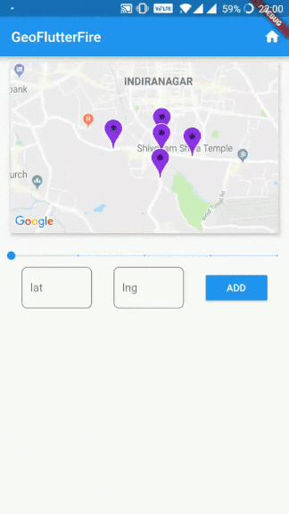
});You now have a realtime stream of data to visualize on a map.
Creates a GeoCollectionRef which can be used to make geo queries, alternatively can also be used to write data just like firestore's add / set functionality.
Example:
// Collection ref
// var collectionReference = _firestore.collection('locations').where('city', isEqualTo: 'bangalore');
final collectionReference = _firestore.collection('locations');
final geoRef = geo.collection(collectionRef: collectionReference);
Note: collectionReference can be of type CollectionReference or Query
geoRef.within(
  center: GeoFirePoint,
  radius: double,
  field: String)
Query the parent Firestore collection by geographic distance. It will return documents that exist within X kilometers of the center-point.
field supports nested objects in the firestore document.
Example:
// For GeoFirePoint stored at the root of the firestore document
geoRef.within(center: centerGeoPoint, radius: 50, field: 'position');

// For GeoFirePoint nested in other objects of the firestore document
geoRef.within(center: centerGeoPoint, radius: 50, field: 'address.location.position');
Each documentSnapshot.data() also contains distance calculated on the query.
Returns: Stream<List<DocumentSnapshot>>
Write data just like you would in Firestore
geoRef.add(data)
Or use one of the client's convenience methods
geoRef.setDoc(String id, var data, {bool merge})- Set a document in the collection with an ID.geoRef.setPoint(String id, String field, double latitude, double longitude)- Add a geohash to an existing doc
In addition to Geo-Queries, you can also read the collection like you would normally in Firestore, but as an Observable
geoRef.data()- Stream of documentSnapshotgeoRef.snapshot()- Stream of Firestore QuerySnapshot
Returns a GeoFirePoint allowing you to create geohashes, format data, and calculate relative distance.
Example:
dart final point = geo.point(38, -119)point.hashReturns a geohash string at precision 9point.geoPointReturns a Firestore GeoPoint
point.distance(latitude, longitude)Haversine distance to a point
NB! geoflutterfire3 is a revisited and updated version of GeoFlutterFire
The work originates from GeoFlutterFire by Darshan Narayanaswamy
